Travel With Max Learn  •  Admire  •  Soar
Karte der frühen latinischen Zentren
Emperor Marcus AureliusThe WarriorMap of Early Latial CentersMap of Ancient Latium SettlementsAncient Latium and NeighborsMithras Slaying the BullMedusaDeity with Serpent CoilsFunerary Stele of Licinia Amias (detail)BoxerPraeneste FibulaPraeneste Fibula

Karte der frühen latinischen Zentren

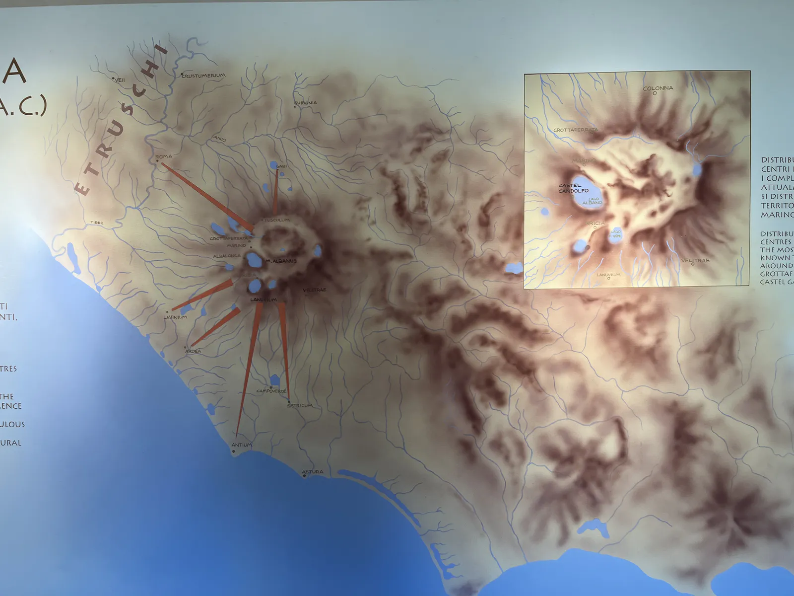
Diese Karte der latinischen Siedlungen (11.–9. Jh. v. Chr.) konzentriert sich auf die vulkanischen Albaner Berge, wo Orte wie Alba Longa und Lavinium den kulturellen und politischen Kern des antiken Latiums bildeten. Ihre räumliche Nähe förderte Zusammenhalt und Identität in der frühen Eisenzeit, als die Topografie sowohl Macht als auch Glauben prägte.
Werbefläche

Want to reach Max with a question, collaboration idea, academic inquiry, media proposal, or a thoughtful note? Use the form below and your message will go directly to him.

KI-Suche